As part of the projects Precision and SmartForest, the Forest Inventory and Monitoring Research Group at NMBU has been researching the use of data obtained from cut-to-length harvesters for forest inventory. We studied how harvester data can be linked to airborne laser scanning (ALS) data to estimate timber volume.
Background
Airborne laser scanning (ALS) data are often used in forest inventory, where forest attributes are estimated from ALS data by linking field data to ALS data in statistical models. For this, accurately georeferenced field data are needed, which is a main cost component in operational forest inventories.
To reduce costs, data recorded by forest harvesters can be used instead of traditional field measurements. Cut-to-length harvesters measure and store large amounts of data on the dimensions and characteristics of harvested logs. Also, harvesters are often equipped with Global Navigation Satellite System (GNSS) receivers which provide a location and time stamp for each harvested tree.

The Komatsu 931XC harvester which collected the data. Yellow circles indicate the GNSS antennas, the yellow arrow indicates the rotation calculated from the GNSS data and the orange arrow indicates the crane length obtained from the on-board computer.
New harvester positioning systems make it possible to position individual trees with submeter accuracy. Such harvester data can be linked to ALS data to estimate forest attributes such as timber volume and stem diameter. These data may be beneficial to a range of inventory uses that fall outside the scope of periodic forest inventories, such as short-term planning of timber harvesting within a region in which a harvester operates. We therefore studied the suitability of harvester data for volume estimation, using ALS datasets acquired with different scanners and over multiple years.
Timber volume estimation
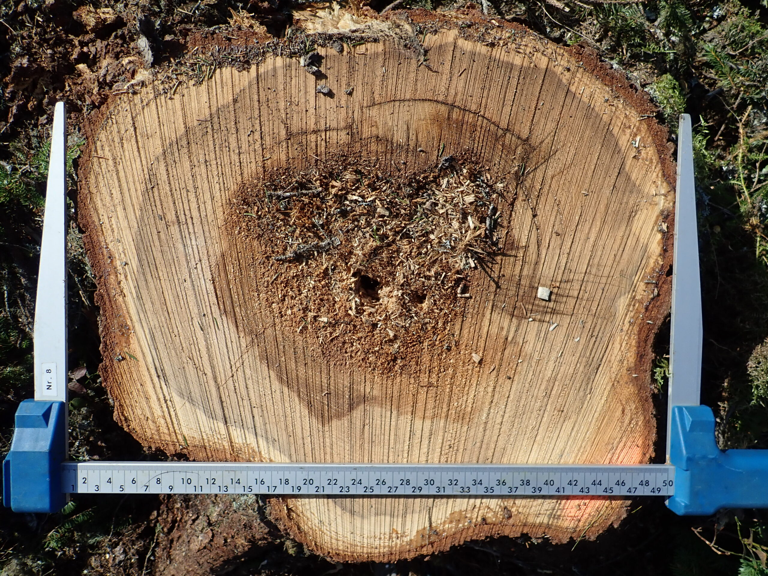
We used harvester data from 33 logging operations collected with a single-grip Komatsu 931XC harvester. We replaced the harvester’s standard GNSS with a real-time kinematic GNSS receiver, with which tree positions were georeferenced with submeter accuracy. Harvester production report (HPR) files were exported in StanFord 2010 format and included log volumes and coordinates of crane tip positions during fellings.
Further, we used ALS data from the years 2013, 2016, 2017, 2019 and 2020, so the delay between ALS and harvester data acquisition varied from one to eight years. We created grids by tessellating the logging sites into cells, and segmented individual trees within the logging sites from the ALS data. The crown segments could then be used to adjust grid cell borders in an enhanced area-based approach.

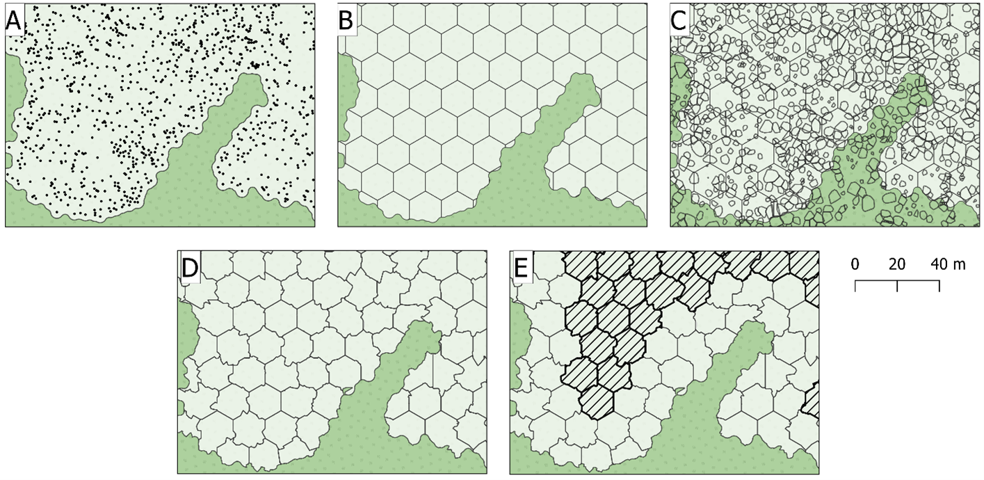
The enhanced area-based inventory approach used in this study. (A) buffer around positions of harvested stems, (B) hexagonal grid, (C) overlay with polygons of tree crowns segmented from the ALS data, (D) cell borders adjusted for segmented trees and sliver cells and (E) cells within a -15 m buffer used in Monte Carlo simulations marked with dashed lines.
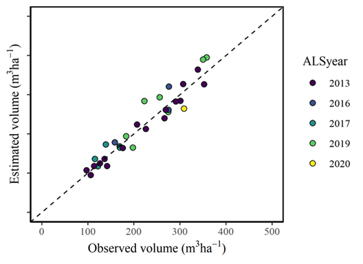
We estimated the mean timber volume per ha for the 33 logging sites and found that even though data from five different ALS acquisitions were used, and the number of years between ALS acquisition and harvesting varied considerably from one to eight years, the year of ALS acquisition did not have a significant effect on prediction errors. So, a single predictive model fitted with data from all years provided a practical solution for predicting and estimating timber volume.

Timber volume recorded by the harvester plotted against timber volume estimated from airborne laser scanner data for the 33 logging operations.
The approach can be used for updating operational forest inventories in situations where field data are not available, and timely data is needed for short-term operational planning. Harvester and ALS data may be especially useful for operational planning, where timber volume estimates are often needed within a short time frame, for example for the selection of stands for harvesting. Such decisions normally need data within a shorter time frame than periodic forest management inventories, which are typically only carried out every 10-15 years.